See it in the glasses.
Read the trailer transcript
This film has spoken narration; the lines below are the on-screen captions, as shown in the picture.
0:02 When people are missing, every minute matters.
0:04 Aerial search. From above, detail is hidden in clutter.
0:06 Live drone video arrives at Lynceus3D Pilot. In the field. In real time.
0:09 Start capture. No second camera. No LiDAR. No cloud.
0:11 First 3D segment lands thirteen seconds in. Capture continues while processing trails behind.
0:15 Each segment lands about eight seconds behind the flight. Click any thumbnail to jump the player to that moment.
0:18 Put the glasses on. An immersive 3D view of the scene.
0:21 Like an IMAX theater, in the glasses.
0:24 Day or night. With or without infrared. Processing keeps pace to the end of the mission.
0:28 Schedule a demo at lynceus3d.com
Watch a mission land.
This is Lynceus3D Pilot on an ordinary Windows 11 laptop†: the operator console, recorded off the screen. A live capture starts, the clock runs from zero, and short 3D segments land on the timeline every few seconds, each one a click from playing in 3D while the feed is still coming in. No processing queue. No model farm.
Eyes on. Eyes in. Thirteen seconds.*
That’s the measured gap on the shipping build between capture starting and the first piece of 3D landing, while the aircraft is still on station. The pipeline pulls two moments of the scene out of the drone’s own motion and hands one to each eye in XR glasses (3D glasses that look like sunglasses). The operator stops looking at the scene and starts looking into it. For decades the live 3D scene was movie fiction. It arrives the moment you click Start Capture and put on the glasses. No tricks, no gimmicks: another dimension to your on-scene decision making.
Every officer sees it, with glasses or without.
ON-SITE · THE GLASSES
The operator and command wear XR glasses that look like sunglasses, plugged into a Windows 11 laptop† in the truck. Each eye gets its own frame and the scene becomes a place you look into, like an IMAX theater showing your own incident: true 3D, one picture per eye, live, while the aircraft is still on station.
OFF-SITE · NO GLASSES REQUIRED
The Surface Elevation (SEV) product line is built for officers away from the scene without glasses at hand: the same flight drawn as height in color (relief: red for the highest surfaces, green for the lowest), on any screen they already have. Gauge vertical obstructions and read the target environment (the staging area, the approach, the structure) from a laptop, an MDT, or a phone.
Nothing compares to what an officer sees in the glasses. The SEV products make sure the officers who don’t have them still see the scene stand up.
Output lands on the displays you already own: side-by-side and top-bottom 3D, PluraView workstations, 3D TVs and projectors, and XR glasses. And depth is computed from the pixels themselves: aircraft with or without flight telemetry (ephemeris) process the same.
After you land is too late.
Mapping and modeling tools fly, land, upload, and hand you a spinning model an hour later: a souvenir of the scene, built for the report. L3DP works while you fly. The pilot and observer see depth as the sensor captures it. Command acts on what they see. The report can wait. The incident can’t.
What hides in a flat frame.
The call that was set as bait.
A brush fire with a rifle waiting behind it. Crews answer what the call says; the scene knows what the call didn’t. Depth reads the ground like a spotter before anyone steps off the rig: the tree line with eyes on staging, the window that owns the approach, the dead ground between cover. The first minutes decide whether everyone goes home.
Gone to ground inside your perimeter.
He’s still inside the tape, somewhere in two acres of backyards, brush, and shadow, and he’s armed. From overhead, flat video shows rooftops and bushes. Depth shows the space between them: where a man fits, where he doesn’t, and which shadow has a shape in it. Clear the yards from the sky instead of at the fence line.
The person the terrain swallowed.
Hour 30, a missing child, or a hiker off the trail. In 2D a human shape is one more patch of texture. In depth it stands apart: under canopy, in brush, against rubble. The same physics that finds the hiding finds the lost. You can’t find what you can’t see.
Built to beat a camera. Not built to beat geometry.
The entrance under plywood and dirt. The cache under netting. The addition dressed to match the roofline. Whatever must not be seen from the air is costumed for a flat camera, and flat cameras take the costume at face value. Relief, the true shape of the ground and whatever stands on it, doesn’t: worked ground sits differently than ground left alone, and a dressed surface stops matching its neighbors. Camouflage beats color. It doesn’t beat geometry.
The address whose story doesn’t add up.
Every address tells a story; this one says nobody lives here, nothing happens here. But the path to the tree line is worn, the turnaround is pressed into the field, the yard is packed hard by traffic that shouldn’t exist, and the vents don’t belong to a house. Activity leaves marks in terrain. Depth makes the marks legible, and the story stops holding up.
More ways in and out than the front shows.
The gap in the tree line, the low spot in the wall, the path that leaves the property where no camera points. Flat video files them under scenery. Depth reads them as routes: cover the exits before the knock, and know how anything, or anyone, arrives and leaves.
Clear the HLZ before the aircraft commits.
Medevac inbound, a hoist, a team going in by air: the landing-zone call is a vertical-obstruction call. Wires, poles, snags, and slope hide in flat video; in relief they stand up where they are. Read the HLZ from the drone in 3D: obstructions, approach and departure paths, the lay of the ground itself, and hand the flight crew a picture they can trust before anyone descends into it. An awareness aid for planning the approach: not a survey, not a chart, and not a substitute for either.
Terrain is the other smuggler.
A border isn’t a line. It’s miles of washes, brush, and canyon that hide movement from flat cameras. Depth reads the hiding places: the arroyo deep enough to walk upright, the brush that swallows a layup site, the route that never skylines. Day or night, from aircraft you already fly, and the same relief that finds the route tells your agents what they’re walking into before they’re in the wash with it.
Every case above, after dark.
Half this work happens when eyes and cameras are at their worst. Depth doesn’t care: it’s computed from structure, not color, so a thermal sensor builds the same model a day camera does. The manhunt at 0300, the search past midnight, the approach staged before dawn: the scene still reads in relief when the picture is nothing but heat and grain. Darkness hides color and detail. It doesn’t hide shape. Snow cover and fog have been flown: where the camera still sees the ground and structures, the geometry still reads.
Plan the way in, and the way out, in depth.
Seeing the scene is half the job; moving through it is the other half. Depth turns overhead video into a route model: which approach keeps a structure between the team and the threat window, which wall is actually tall enough to break line of sight, and which fence just hides you without stopping anything, where the ground dips low enough to move unseen, and which way out stays open if the first one closes. Object heights, terrain, and sight-lines: read them before anyone moves, not while they’re moving. That isn’t convenience. That’s officer safety.
Sharper than Lynceus.
Pronounced LIN-see-us in English · lin-KEE-us in Classical Greek.
“He sees more sharply than Lynceus.”— the Greek proverb for impossible powers of observation
Lynceus was the lookout of the Argonauts: the crew member whose gift wasn’t strength but vision. The myths say his sight reached through forest canopy and past every appearance, finding what was hidden from everyone else. His eyes never won the battles. They told the heroes where to act.
That is the job of a drone program at an incident. Not to lift the rubble or wade the flood: to see the scene so clearly that the people who do can move with certainty. Heracles was assault. Odysseus was strategy. Lynceus was reconnaissance. We named the company for the one whose vision brought the rest of the crew home.
When the ground itself is the emergency.
Which pile was a building.
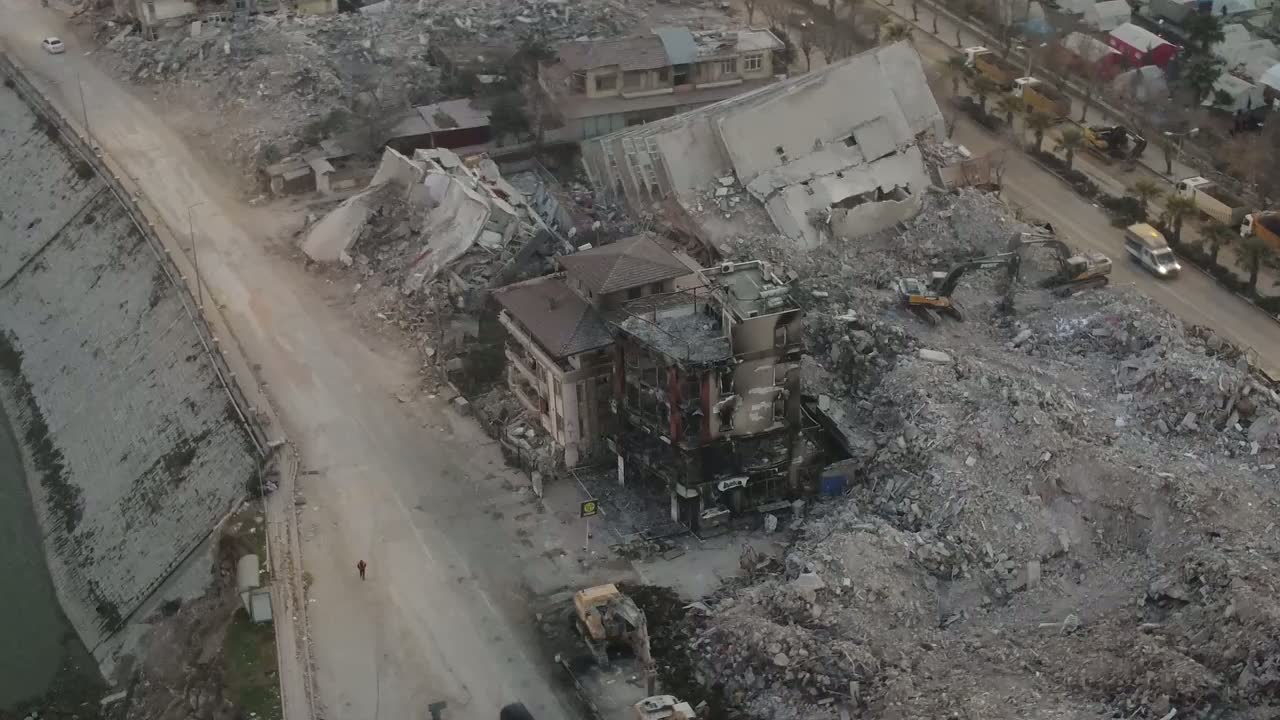
After the shaking stops, flat video shows rubble everywhere, and every pile looks like every other pile. Relief tells them apart: the block that pancaked to grade, the building still standing beside it, the mound that used to be three stories with people inside. Rescue gets one first hour to decide where to dig. Depth turns that guess into a choice.
Is the roof still holding.
A working fire is a geometry problem: where the ladder reaches, which run of roofline has started to sag, how far the collapse zone extends past the wall. Depth reads the structure while the crews work it. And where smoke owns the frame, the layer reports no data instead of inventing an answer. On a fireground, a confident wrong answer is the only thing worse than none.
The honest ledger.
When it’s over, command owes everyone an accounting: which structures survived, which blocks scoured to the foundation, where it stopped. Mud and glare flatten a 2D frame into one gray smear. In relief the ledger writes itself: standing walls read tall, cleared lots read flat, and the line where the losses end is a line you can walk.
Made for the hours before the maps exist.
Every disaster gets mapped eventually: surveyed, modeled, measured, weeks deep in the file. The first hour gets none of that. It gets whatever the first aircraft sees. L3DP is built for exactly that gap: first depth reaches the crew seconds after capture starts, from the drone your team already flies, while the calls that decide outcomes are still being made. The survey can take its time. The first hour can’t.
The backbone, read from the air.
A yard of gray steel, legible at last.
After a storm, or ahead of one, the questions about a substation or a transmission corridor are structural: what’s standing, what’s bent, what the vegetation is closing in on. Flat video turns a switchyard into one gray texture. In relief the yard becomes legible: gantries, transformer banks, and tower runs stand apart from the ground and from each other, so the first orbit becomes a structural read, and crews roll to where the damage is, not where the guess was.
See what stands up before you work low.
Tall and flat look alike in a flat frame.
Low-altitude work (a medevac approach, a night search, drone operations under a ceiling) shares its airspace with everything that sticks up: masts, towers, tree lines, and the terrain itself. Overhead video flattens all of it. Relief makes height the signal: the antenna farm on the crest, the poles down the access road, the ridge that rises faster than it looks. It’s an awareness layer for the people planning the work: not a survey, not a chart, and not a substitute for either, just the fastest way to put the tall things in front of the crew before the crew is in front of them.
Fly the mission, not the choreography.
Turns, reversals, straight down to a steep side view: the picture holds.
Real searches don’t fly in circles. They run legs, reverse at the grid line, cut back, change the look angle, whatever the pattern demands. L3DP is flight-proven through exactly that: serpentine routes with a hard reversal at the end of every leg, from straight down to a steep side view, on the same aircraft in the same pass. The loop below is one of those turnarounds, flown straight down over unbroken canopy: the aircraft swaps direction mid-frame, and the elevation layer holds through the turn. Depth belongs to the flight you need to fly, not the one the software wishes you’d flown.
Fly. Click. Wear. Share.
Your existing drone
The single camera you already fly, day or thermal. Your pilots, your aircraft, your standard flight profile.
Start Capture
One control. Depth is computed from the aircraft’s own motion as it flies: no second sensor, no base station, no cloud dependency. First depth reaches the crew seconds after capture starts, not after the aircraft lands.
Sunglasses, not a headset
Lightweight viewing glasses. The scene arrives in real 3D and you look into it, the way an IMAX theater puts you inside the picture. No model to wait for.
Share it two ways
The video shares like it always has: flat, anywhere, evidence intact. For Lynceus3D Pilot-equipped teammates, depth travels with it at almost no added size. For everyone else, export a universal depth file any 3D-capable display can play, including a phone paired with today’s XR glasses.
One size of 3D has never worked.
Depth isn’t a filter. It’s a fit. You’ve seen bad 3D. Everyone has. That’s because almost every 3D system ever shipped had one depth setting: chosen once, applied to everything. Depth is geometry: it changes with altitude, range, look angle, and how the aircraft is moving. A fixed setting is accidentally right in one scene and wrong in every other: too shallow and the picture goes flat, too deep and you get the eye strain 3D is famous for. One size has never worked. It can’t.
Lynceus3D Pilot measures the scene before it renders it. Every flight, the system works out how much 3D the scene can carry, from the aircraft’s own motion, continuously, as conditions change. Then it renders six calibrated depth levels from that single pass, switchable instantly at playback. Comfortable for the long watch. Deeper to interrogate a structure. Maximum to pull a hidden shape out of clutter. The operator tunes depth like volume, and your eyes always settle it into one picture, because it was never a guess.
One-setting 3D fails for a reason: how much depth a scene can carry is decided by how it was flown, not by preference. We measure it for every scene, then give you six steps of it.
Built for incidents, not screening rooms.
LIVE
Depth in near-real time, while the aircraft is on station. The freshest terrain product in the world is hours old by delivery; an incident ages by the minute. This is the layer in between.
SOURCE-PRESERVING
The source recording is never modified: what the drone captured is bit-for-bit what evidence receives, and every processing decision is logged and auditable.
FULL ENVELOPE
Valid depth across every look angle a mission flies, straight down through steep side views. Looking straight down, forest separates into layers.
ANY SENSOR
Day camera or thermal: same result. Depth comes from structure, not color, so night operations get the same model.
A FORCE MULTIPLIER WHEN IT’S UGLY
Real incidents don’t produce studio footage. Haze, distance, zoom, compression: the depth cue keeps reading as fine detail thins out, helping most exactly when conditions turn against you.
ZERO FRICTION
No second camera. No LiDAR. No GPS dependency. No training data. Depth adds almost nothing to the size of the video you already move: nothing to integrate, nothing to break.
Elevation, sorted by color. Another way L3DP shows the Z-axis: the source on the left, its live elevation layer on the right, computed in flight.
Flight-proven. Evidence-clean.
- Proven in live flight on our own FAA-registered aircraft under Part 107, not a simulation, not a render farm.
- Depth from real camera geometry. Not an AI’s guess trained on someone else’s data: computed from your aircraft’s actual motion, repeatable and auditable.
- Your evidence stays yours. Source video is never altered; verification against the original always matches.
Built by someone who spent a career in overhead surveillance.
Where this is going.
Lynceus3D Pilot · pre-flight
The planning seat. Lay out the flight that produces depth before the aircraft leaves the ground: the passes and their turnarounds, the orbits, the perimeter box, the battery legs, the airspace check. Hand the route to the controller and fly it.
Lynceus3D Pilot · on site
The operator’s seat. Capture, process, and command the depth picture at the scene, from a Windows 11 laptop†, while the aircraft is still on station.
Lynceus3D Viewer · off site
The support seat. Drone support teams away from the scene open the same missions and read the same relief, with 3D glasses or without them.
Near-real-time line-of-sight estimates
Which ground a position can see, and which it cannot, estimated from the flight’s own relief while the aircraft is still on station: cover, exposure and the approach read as sight-lines, not as guesses.
Watch the pieces fit together.
One search, start to finish: the long orbit, the depth picture, the glasses, the overwatch points, the way in. This is the roadmap in practice: how the pieces fit together on one incident, in one minute fifty-two.
Read the film transcript
This film is narrated. The transcript below is the same wording shown in the picture; the spoken lines are drawn from it.
0:05 One man running. Three hundred acres. He knows these woods - he's hunted them.
0:09 Every minute he's loose, the circle grows.
0:13 The long orbit. Too far to hear. Too high to spot.
0:18 In depth, the hill gives up its overwatch points. And tracks, going up.
0:23 The ATV, tucked into the trees. The long-range surface is still processing.
0:28 Any 2D drone video in.
0:31 First 3D segment - thirteen seconds in.
0:34 3D video out - while the aircraft is still flying.
0:41 Inside the glasses: the scene in 3D.
0:50 Your incident has a Z-axis. A simulation of a real-world scenario. In stereo, movement ghosts - something is walking.
0:56 Eyes can’t find him. Depth can.
1:05 There he is. No weapon in view.
1:11 Camo. Intent unknown.
1:14 The maps of this hill are decades old. The surface from the flight is not.
1:18 One way in: his own ATV trail. If he’s hostile, every step is exposed.
1:21 A flat map says he can see everything.
1:25 The measured forest hides half of it. Line of Sight from any point you pick - coming to Pilot.
1:35 It took a team to bring him in. Every resource. No force required. Everyone went home.
1:40 Near real time. On scene. In glasses.
1:43 His eyes never won the battles. They told the heroes where to act. — Lynceus, lookout of the Argonauts
1:47 LYNCEUS3D PILOT · Patent pending · FAA Part 107 · SBA-certified SDVOSB · Made in New Hampshire · You can’t find what you can’t see. 3D vision is one click away.
You’ve already spotted what this is.
If you’ve spent a career with FMV, the page above reads differently: single-aperture stereoscopic exploitation, valid nadir through highly oblique, sensor-agnostic across day and IR, with or without platform ephemeris: no second camera, no DEM, no control points, no training data. And the source pixels are never touched. Terrain products give you the ground as of the last collection; this gives you the scene as of now. They compose. If that paragraph reads like your job description, ask for a trial version.
And you know the lineage: photo interpreters have broken camouflage with stereo pairs since Medmenham, and Julesz proved why: “with stereoscopic vision there is no camouflage.” We put the eighty-year-old advantage on a live drone feed.
Issued to you, not posted for the world.
Lynceus3D Viewer (L3DV) is free for command staff and off-site personnel: register and we issue your download link and activation code. Lynceus3D Pilot (L3DP), the operator seat, is issued with your 60-day evaluation. Every install activates offline (no cloud account required) and updates preserve your activation.
Trained in ten minutes.
The complete operator walkthrough: capture to playback, every control on screen. 10 minutes 27 seconds, silent, captioned.
Read the walkthrough transcript
No audio in this video — every explanation appears on screen. The transcript below is the same wording shown in the picture.
0:00 · Title
0:00 [title card] Your incident has a Z-axis.
0:08 · Source
0:12 Start here: tell Pilot what you are flying Set the camera once - Live Flight and Post Flight share it
0:22 Automatic reads the .SRT telemetry An explicit pick overrides it
0:32 Three ways in: a USB capture card, a file that is still growing, or RTMP from the controller
0:37 Select your drone BEFORE Start Capture.
0:40 · Capture
0:43 Point it at a folder Capture, segments and 3D output all land here
0:50 Start Capture. That's it, everything else is automated.
0:58 Stop Capture finishes cleanly The last segments still complete
1:03 End Mission clears the filmstrip Use it between missions, not during one
1:06 · Status + Segment Timeline
1:09 Five seconds of flight, then processing
1:19 The first thumbnail lands about thirteen seconds in
1:24 After that, one segment every five seconds while you are still flying
1:50 The amber marker is a new capture boundary
1:56 "1 ahead" is the backlog - one segment waiting The machine is keeping up with the aircraft
2:04 Click any segment to jump the player to that moment
2:11 · Live Controls + Advanced
2:14 Six depth levels, live Grey until the timeline is ready, green when it is
2:20 3D0 is flat. 3D5 is maximum separation. 3D3 is the working default.
2:27 Pick the one that is comfortable That is an operator choice, not a setting to get right
2:33 Advanced Settings: set the display target once and forget it
2:37 Live controls, while the aircraft is still up.
2:39 · Input
2:43 Post Flight is for footage you already have Single File, a Folder, or a whole Playlist
2:55 Browse to the clip you flew Pilot reads the same telemetry Live Flight would have
3:07 RUN STATUS is the one place to look Idle, Running, Pass - no hunting through a log
3:21 · 3D Video Output
3:25 This is the 3D deliverable - the video you hand to someone Output Product picks the container
3:35 Original Resolution keeps every pixel you flew The rest are headset and display presets
3:47 Depth Level does the same job as the live ladder applied to the whole clip instead of one segment
3:57 Output FPS follows the source unless you force it Auto is the safe answer
4:05 Quality is the encoder's budget, not the geometry Excellent is the working default
4:13 Where it lands, and what it is called
4:21 Process Video. One pass, every product you ticked.
4:26 Hand the file to anyone. No plugin. No viewer.
4:29 · Surface Elevation Video
4:33 The Surface Elevation Video turns the flight into terrain you can read Camera tells the geometry what lens you flew
4:42 SEV Products picks which surfaces get written SEV, SEVSBS2D, SEV3D, or all of them
4:52 Gimbal: Auto for most flights On an orbit, geometry works it out from altitude and radius
5:01 Depth Level again, this time for the surface Automatic reads the evidence and chooses
5:11 SEV Terrain - Calibrated reconciles the surface against the terrain Raw keeps the movers and the anomalies instead
5:23 Auto is 1920-class relief Full resolution buys more discrete depth, and costs render time
5:33 Full is 30 fps Third is 10 fps, about three and a half times faster
5:42 Flight Package bundles each clip for sharing, automatically
5:48 Relative elevation. Highest, Lowest, No Data.
5:51 · Processing
5:55 Processing Streams is how many clips run at once Auto reads the machine instead of guessing
6:05 Run Report writes down what actually happened
6:14 so a long batch is auditable after the fact
6:20 Set it once. It remembers.
6:23 · System
6:26 SYSTEM points Pilot at its media tools
6:33 Use the FFmpeg shipped with the build A different version changes the depth engine's calculations
6:39 Apply writes the paths. Set once, then forget it.
6:47 · Mission Catalog + Active Clip
6:50 Every clip Pilot has processed, in one list
6:58 Green is ready. Amber is still processing. Hollow is missing.
7:04 Active Clip tells you what you are holding
7:10 How long the flight was
7:15 Which eye is which - Auto unless you override it
7:19 and which products exist for it
7:23 Pick a clip. Everything below follows it.
7:25 · Depth Ladder + Live Timeline
7:28 The same six levels, now against a finished flight
7:34 3D0 is flat. 3D5 is maximum separation. 3D3 is the working default.
7:41 The timeline is every segment of the mission
7:51 Click one and the player jumps there
7:57 Change depth without losing your place The segment you picked is still the segment you are on
8:04 Six levels. One flight. No re-render.
8:07 · 3D Video Player + Display
8:11 Put the glasses on XR glasses take a left/right pair; a PluraView takes top and bottom
8:21 On a multi-monitor desk, tell Pilot which screen is the player
8:31 For a top-bottom rig, name the top display
8:41 and the bottom one. It remembers both.
8:51 Source picks what the player is fed One file, a folder, or a whole flight package
9:01 Your desk. Your rig. Pilot adapts.
9:05 · Playback + Transport (RE-POINTED)
9:09 Pick the depth you want to fly back through
9:19 and the segment you want to start from
9:29 Play 3D sends it to the display you nominated Pause, Exit and Restart do exactly what they say
9:39 Swap L/R if the eyes are reversed You will know within a second of looking
9:46 Playback is one row of buttons. That is the point.
9:49 · Advanced Settings (RE-POINTED v2)
9:52 Show Advanced Settings opens the extras Nothing here is needed for normal playback
10:00 Advanced Settings: the tools you reach for rarely
10:09 ACTIVE CLIP always reads back the clip you selected
10:17 · Close
10:17 [end card] LYNCEUS3D PILOT - Patent pending . FAA Part 107 . SBA-certified SDVOSB . Made in New Hampshire
10:22 [end card] You can't find what you can't see.
10:24 [end card] 3D vision is one click away.
You can’t find what you can’t see.
3D vision is one click away.
Fifteen minutes, our glasses, your footage. If your department flies, you already own everything else the demo needs.
Or call (603) 505-3132 · Prefer email? demo@lynceus3d.com · Pilot programs available for New Hampshire departments now